


If you’ve ever worked on a construction project, you know this truth: the ground always has the final say. Drawings may look perfect, estimates may feel airtight, and schedules may appear achievable—but once the machines hit the soil, surprises happen. Rock layers, groundwater levels, and unexpected soil conditions—these hidden realities can turn a well-planned project into a financial and operational nightmare.
Ground data in takeoff workflows is no longer optional-it’s project-critical and with the rise of AI-based takeoffs, ignoring ground conditions during the estimating phase means leaving your project exposed to costly risks.
In this blog, let’s break down why integrating geotech data in takeoffs matters, how it connects with site data integration, and what role AI can play in making ground information not just a footnote—but a foundation.
Why Manual Takeoffs Can Mislead Your Estimates
Manual takeoff workflows have always focused on drawings and specifications. Estimators quantify structural steel, concrete, rebar, finishes—you name it—based on what’s shown on the sheets. But rarely do they pause to ask: What lies beneath the surface?
That’s where the problem begins. Many project delays and budget overruns aren’t the result of design miscalculations—they’re the result of misjudged ground conditions.
Think of it this way:
- A foundation designed for soil that turns out to be rock-heavy can double excavation costs.
- Underestimated groundwater can require dewatering systems, adding both time and money.
- Weak soil strata might call for ground improvement techniques, completely shifting the project’s scope.
When ground data is ignored, your estimate looks accurate—until the site reality shows up to prove otherwise.
Why Ground Data is Important in AI-Based Takeoff Workflows?
AI-based takeoffs have already changed the game for estimators. With AI automating the takeoff process, you’re no longer tracing lines for hours or second-guessing scale errors. AI can extract quantities faster, more accurately, with better detail than manual methods ever allowed.
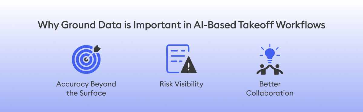
Here’s why ground data in takeoff workflows makes a difference:
- Accuracy Beyond the Surface
AI can give you the exact rebar count or concrete volume, but without site-specific geotechnical inputs, it doesn’t account for the practical challenges of building on that ground. - Risk Visibility
Integrating geotech data in takeoffs allows estimators to see potential risks upfront. Soil stability, groundwater depth, or rock layers aren’t just data—they’re risk signals that inform contingency planning. - Better Collaboration
When ground data is included in early takeoff workflows, it opens the door for proactive collaboration with geotechnical engineers. Instead of reacting to site surprises, teams can plan for them.
Real-World Scenarios Where Ground Data Matters
Let’s make this less abstract. Here are three situations where ignoring ground conditions derailed projects—and where including geotech data in takeoffs could have saved millions:
- The Unseen Rock Layer
A project budgeted excavation based on assumed soil conditions. Halfway in, they hit a rock layer that required specialized equipment. Costs doubled, timelines stretched, and profit margins shrank. - Groundwater Surprise
A commercial site underestimated the groundwater depth. When the foundation pits flooded, the team scrambled to install dewatering pumps. The fix was effective but expensive—something that could’ve been predicted with proper ground data. - Weak Soil Support
A highway expansion assumed uniform soil. In reality, parts of the site had weak, compressible soil, requiring soil stabilization measures. The oversight added months of delay and significant cost escalations.
Each of these issues started not on site, but in the estimating phase—where ground data in takeoff workflows was overlooked.
Final Thoughts
Bids may look like numbers on paper, but construction is built on the ground beneath. Embedding ground data into takeoff workflows ensures estimates that win, not just projects, but profits.
By embedding ground data in takeoff workflows, connecting it through site data integration, and leveraging geotech data in takeoffs, AI can finally deliver what the industry has always wanted—estimates that don’t just look good on paper but stand strong on site.
Because at the end of the day, construction isn’t built on drawings. It’s built on the ground. And the more you know about it before you bid, the better your chances of winning—not just the project, but also the profit margins that come with it.


.jpg)
.webp)

