

Why Earthwork Estimating is a crucial part of the construction process ?
Earthwork estimating is one of the most precise aspects of preconstruction estimating. Grading, volume, and site conditions, if estimated inaccurately, can lead to large cost variances. The larger and faster a project becomes, the less justifiable manual estimating and fragmented tools become. Modern earthwork takeoff software fills this gap. However, the tools vary, and picking one software affects your bid speed and accuracy, and the project's overall risk.
The following highlights the real-world estimating tools most important when selecting software.
What Earthwork Takeoffs Involve
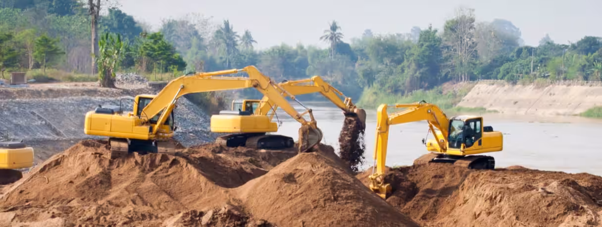
Cut and fill calculations
.avif)
Cut and fill takeoff is the first and most important step to understanding the total earthwork. It breaks the earthwork down into two categories: cut or fill. These categories impact haul, equipment, and the overall feasibility of the project.
Grading and terrain modeling
Accurate software to create grading plans is a must. These plans must interpret real site conditions, which require tools that can predict contours, slopes, and site elevations, not flat-site estimations.
Quantity estimation for excavation and backfill
Estimators must also define and quantify disparate fill types/layers, takeoff depths, and fill types. These estimations also impact the cost takeoff for the project, which draws from excavation and compaction. Earthwork quantity takeoff software helps estimators define these earthwork quantities and does quantity estimation for grading and backfills.
The Importance of Feature Selection in Earthwork Estimating
Accuracy impact on project cost
In large infrastructure projects, even a slight error in volume calculation may amount to a loss of thousands, or even millions, of dollars. The right software with built-in cut and fill calculations may help mitigate this loss.
Handling large terrain datasets
Most civil and infrastructure projects require the management of large data sets. The software's ability or inability to manage the required complexity may significantly impact the outcome of the project.
Bid speed and consistency
In order to remain competitive, businesses must provide estimates that accurately describe the cost of the project. This must be done consistently for all team members and all project participants.
Beam AI customers, including Bommarito Construction and Team HB, were able to provide faster and more automated takeoffs, enabling team members to provide more accurate estimates and reducing the time they spent compiling them.
Feature 1. Accurate Cut and Fill Calculation
.avif)
Volume calculation methods
Good mass excavation estimating software should incorporate methods that provide estimates based on cut and fill that rely on grid and triangulated surfaces and sectional estimates. A flexible methodology provides better estimates for diverse project types.
Handling variable terrain conditions
Most civil infrastructure sites do not have a consistent topography. Software must be able to manage that complexity, including uneven surfaces, changes in elevation, and silt or soil layers - all of which may result in uneven surfaces, without manual assistance.
Operational Benefit - Reduced material quantity risk
Good volume estimates reduce the likelihood of budget overruns caused by poor evaluation of the materials required for construction.
Feature 2: Terrain and Surface Modeling
.avif)
Digital terrain model support
Good grading takeoff software should support Digital Terrain Models (DTMs) so that estimators can easily visualize and interact with site topography.
Surface comparison capabilities
Understanding the impact of grading requires the comparison of existing and proposed surfaces. Advanced surface comparison tools eliminate the need for manual model rebuilding.
Operational Benefit - Improved grading precision
With terrain modeling innovations, estimators can realistically improve grading and achieve the expected results with minimal surprises during execution.
Feature 3: Support for Large Site Data
Handling complex site plans
Large infrastructure/civil projects include dense cross-sectional drawings, multiple overlapping layers, and scopes that must be processed in a crashless and lagless manner.
Performance with large datasets
Speed and efficiency are paramount. Digital earthwork takeoff software workflows tend to be slowed down by model updates and renormalization routines.
Operational Benefit - Scalable estimating for infrastructure projects
The nature of scalable systems allows teams to safely take on larger and more complicated projects inestimably.
For Team HB, scalability played a key role in managing multiple projects.
Feature 4: Revision and Change Management
Tracking drawing updates
As designs continue to change, revisions must be automatically detected in the drawing versions. An effective civil earthwork estimating tool must do this.
Recalculating quantities efficiently
Estimators can update takeoff quantities based on the revisions instead of beginning the takeoff from scratch.
Operational Benefit - Faster response to design changes
Ultimately, this allows teams to rapidly respond to changing bid requirements, which is critical for winning competitive bids, and helps to reduce rework from multiple iterations.
See how Wildstone Construction cut daily takeoff time from 3–5 hours to 1–3 and submitted more bids.
Feature 5: Standardized Cost Libraries
.avif)
Using standard assemblies for sitework
Arranging for standardized assemblies gives your team reusable costs for excavation, hauling, grading, and backfilling
Consistent estimating across teams
For multiple estimator teams working together, consistency becomes paramount. Having a shared library provides alignment.
Operational Benefit - Improved bid consistency
This provides less variability in estimates and provides a more predictable bidding process across multiple projects.
Beam AI provides the AI-based software teams need to maintain consistency as they scale with multiple estimator teams.
Feature 6: Collaboration and Team Workflows
Real-Time Collaboration of Estimators
Estimating is not something that an estimator does by themselves. There needs to be a collaborative effort by teams to pull together large estimates in real-time.
Role-Based Access and Workflow Processes
Estimators, managers, and reviewers need to have designated roles in order to maintain control and accountability for the estimate.
Operational Benefit - Coordinated multi-estimator workflows
This enables parallel workstreams, faster reviews, and better coordination across teams.
In practice, companies using Beam AI have reduced bottlenecks by allowing multiple estimators to work on the same project simultaneously.
Feature 7: Reporting and Bid Documentation
Quantity summaries and breakdowns
Clear summaries of volumes, materials, and costs are essential for internal validation and external proposals.
Exportable reports for proposals
Reports should be easy to export and present - whether for clients, stakeholders, or internal approvals.
Operational Benefit - Clear documentation for stakeholders
Well-structured documentation improves transparency and builds confidence in your estimates.
How to Evaluate Earthwork Takeoff Software in Practice
When selecting sitework estimating software, it is important to consider how that product will perform in real life versus simply checking off features from a list. You must also try the solution with respect to these three criteria to ensure it saves time versus providing additional levels of digital frustration.
Match Features to Project Type
.avif)
Not all dirt is moved the same way. A software package designed for high-density residential pads might struggle with the complex transitions of a highway interchange or the precision required for a golf course renovation.
Linear vs. Site Work: If your business revolves around road construction, then you will want to have strong cross-sectional capabilities for both cut and fill, along with mass haul calculations. When working on commercial sites, you will want to have excellent trenching techniques as well as methods to adjust for varying subgrade elevations.
Geotechnical Sensitivity: When working with geotech (soil) type information, is the program able to accept boring logs? If you are working in an area with a lot of rock and only a little soil, then having the ability to calculate differentially and the volume of soil to be removed is critical.
Deliverable Depth: When determining how your deliverable product should look, consider how much detail will be required. You may wish to use a grading takeoff software as your deliverable product, or you may wish to have a 3D model, which could then go on to a GPS-equipped fleet.
Test Workflow Efficiency
A good tool will not work as a good tool if it takes you 40 steps to do a calculation. To "humanize" the technology you have means that you want the software to perform at the same rate that you think.
The Clean Up Factor: You will receive most CAD or PDF files with extra layers and broken lines, so you will need to identify how quickly your software will let you isolate those layers and join the broken lines. If you have to spend three hours cleaning up your data before you can even start to take off, then the tool is a bottleneck.
Ease of Revision: Construction is a world of change orders. So, for example, if an engineer moves a pond ten feet to the left, do you need to go back to square one? Good software should allow you to dynamically update the volumes when you move them.
Visual Validation: Look for a 3D drive-through feature, which is the quickest way to identify a spike or hole in your data, which will lead to large bidding errors.
Assess Scalability and Data Handling
Your application must be able to manage your most significant, most challenging project without crashing. Productivity isn't really productive if the software stops working when an upload is attempted for a high-resolution drone inspection or a 50-page plan set.
File Size and Latency: Load a heavy dataset - something with thousands of contour lines. If there is a lag when zooming or panning, that frustration will compound over months of use.
Integration with the Ecosystem: Does the data play nice with your bidding software or project management tools? Scalability is also about how well the takeoff data flows into Agtek, B2W, or Excel without losing its integrity.
Common Mistakes When Choosing Sitework Estimating Tools
Focusing only on interface features
A clean UI is helpful, but it doesn’t guarantee accuracy or scalability. Core calculation capabilities matter more.
Ignoring data management capabilities
Handling large files, revisions, and multiple datasets is critical. Weak data handling can slow down even the best teams.
Overlooking scalability requirements
Choosing a tool that works today but fails under larger workloads can limit growth and create long-term inefficiencies.
Final Thoughts
When selecting a suitable earthwork takeoff software, the emphasis should not be on features but rather on developing a more effective way for your employees to do their jobs. Having efficient, construction-grade calculation capabilities and scalable process flows will help increase both the speed of your bids and their reliability.
If you are still working via old processes using manual methods and broken-down tools, it's time to take another look. There has been a significant change between the two (i.e., "traditional" and "modern") ways of performing work and estimating, as demonstrated by the rapid growth in the use of artificial intelligence technology in estimating. i.e., that change is now considered separate from other operational improvements.


.webp)

