AI-Based snow removal takeoff software
Your snow removal takeoff process is slowing you down!
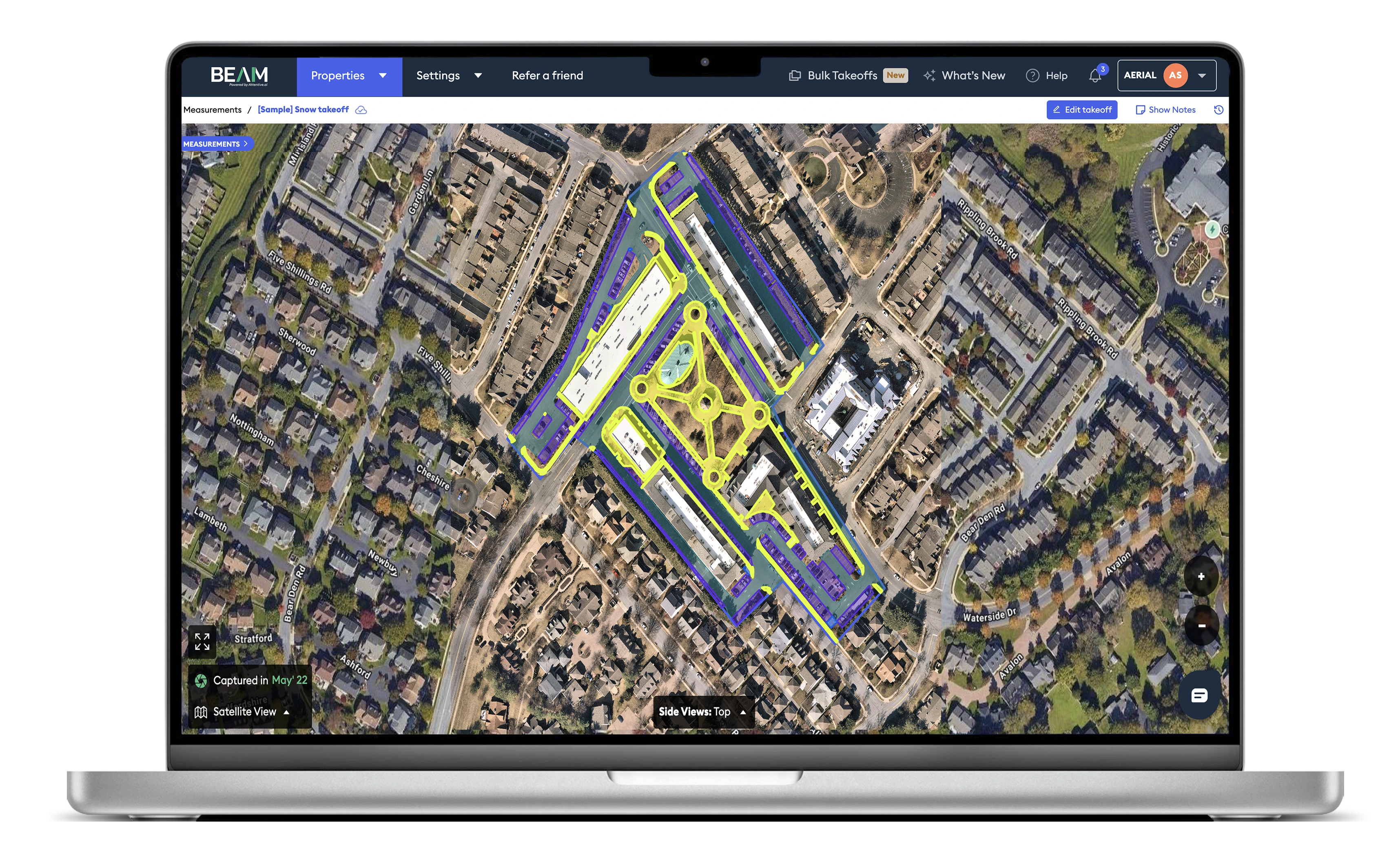
With Beam AI, you get 100% automated measurements for drive lanes, sidewalks, pavements, and parking lots, saving 90% of your time and helping you push 2X more bids without the manual grind.
Trusted by 900+ landscaping & snow removal businesses


How our AI-based snow removal takeoff software works
Generate fully automated snow removal maintenance takeoffs in 4 simple steps
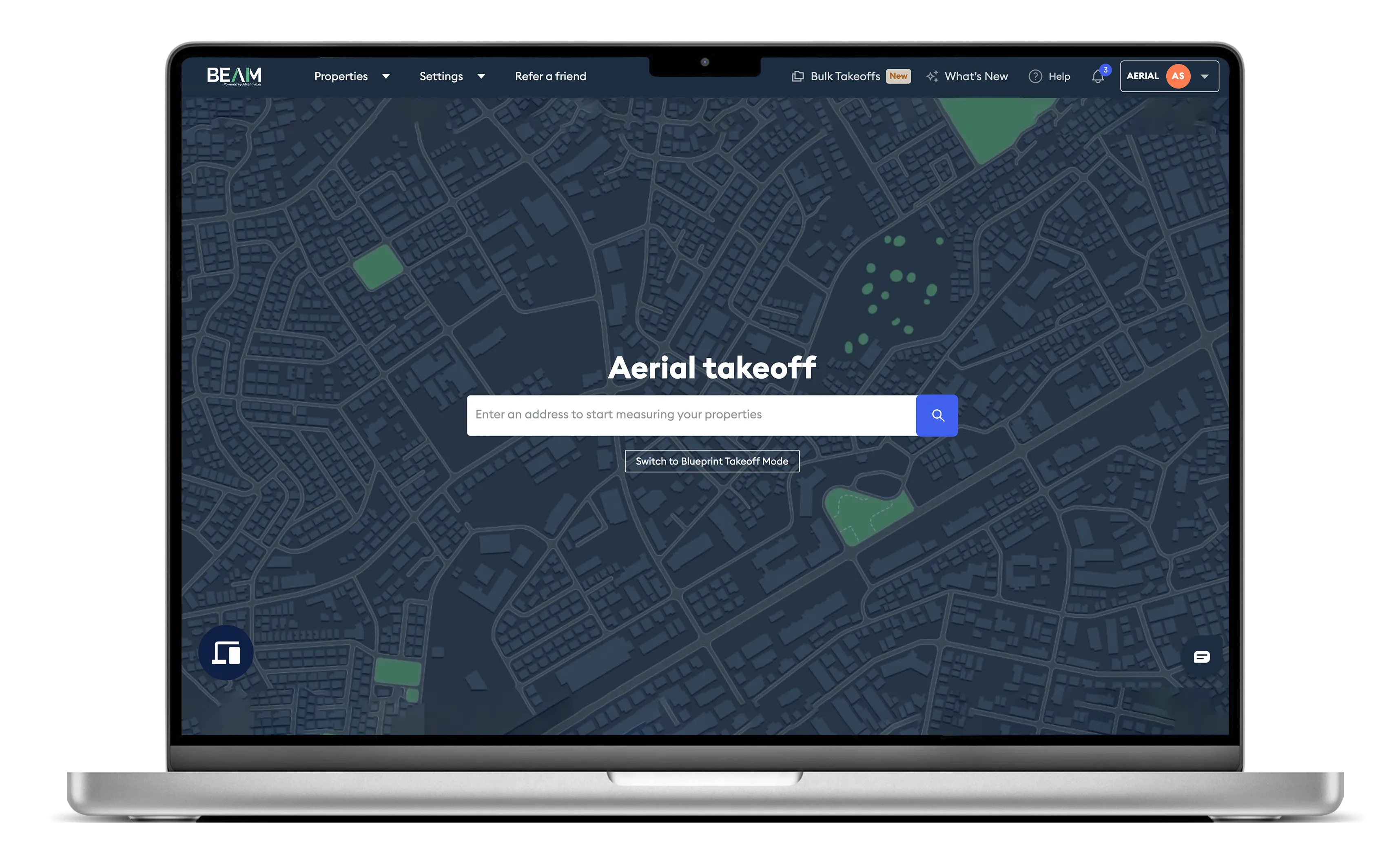
Enter the property address
Add the property you want to measure. Our system pulls up the location instantly using high-resolution aerial imagery.
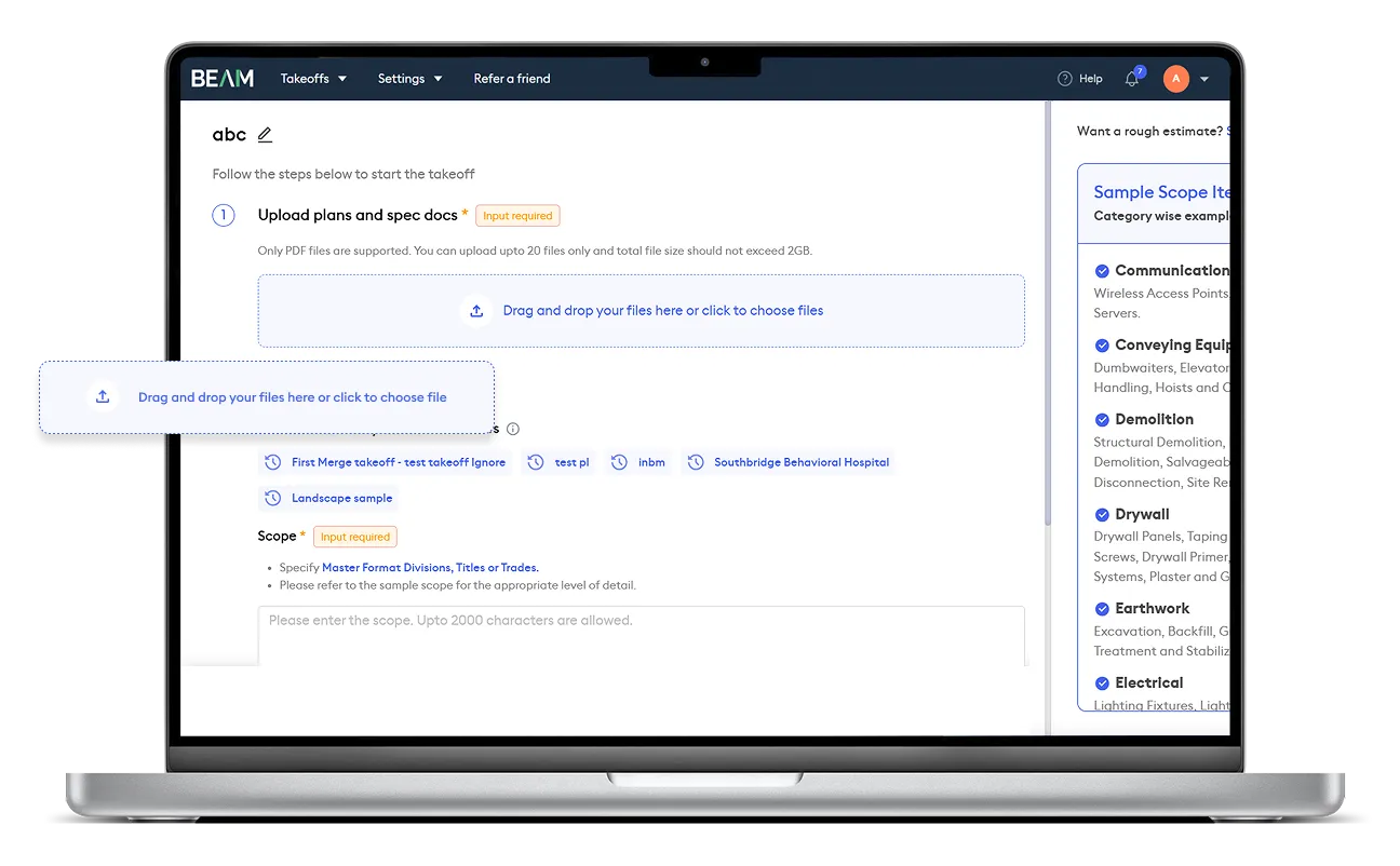
Confirm the lot boundary & add project details
Review the predefined lot boundary and adjust if needed. Upload any sitemaps or project notes for added context.
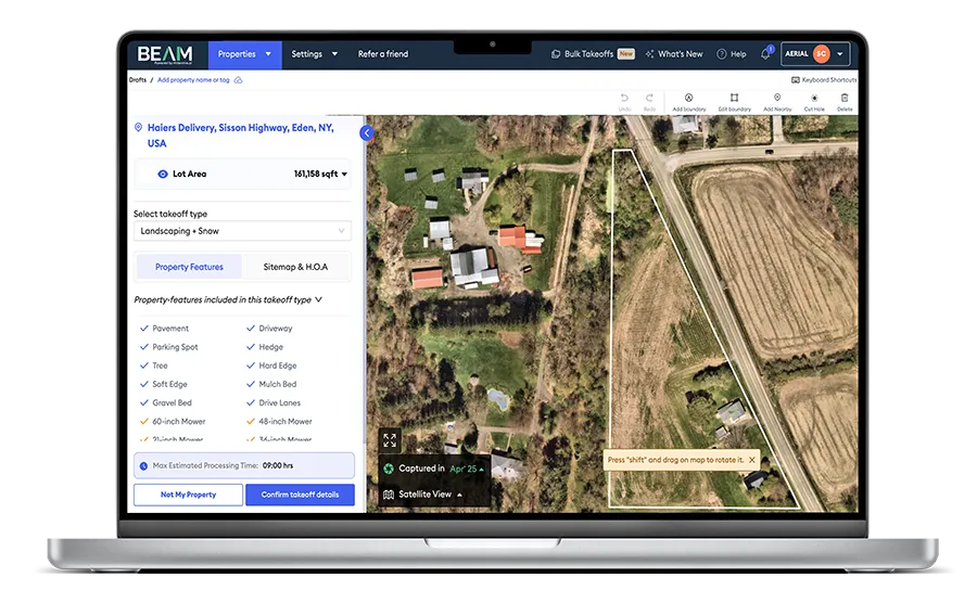
Review & let AI do the takeoff
Once you’ve confirmed details, Beam AI automatically captures all snow removal elements, including drive lanes, parking lots, pavements, and sidewalks.
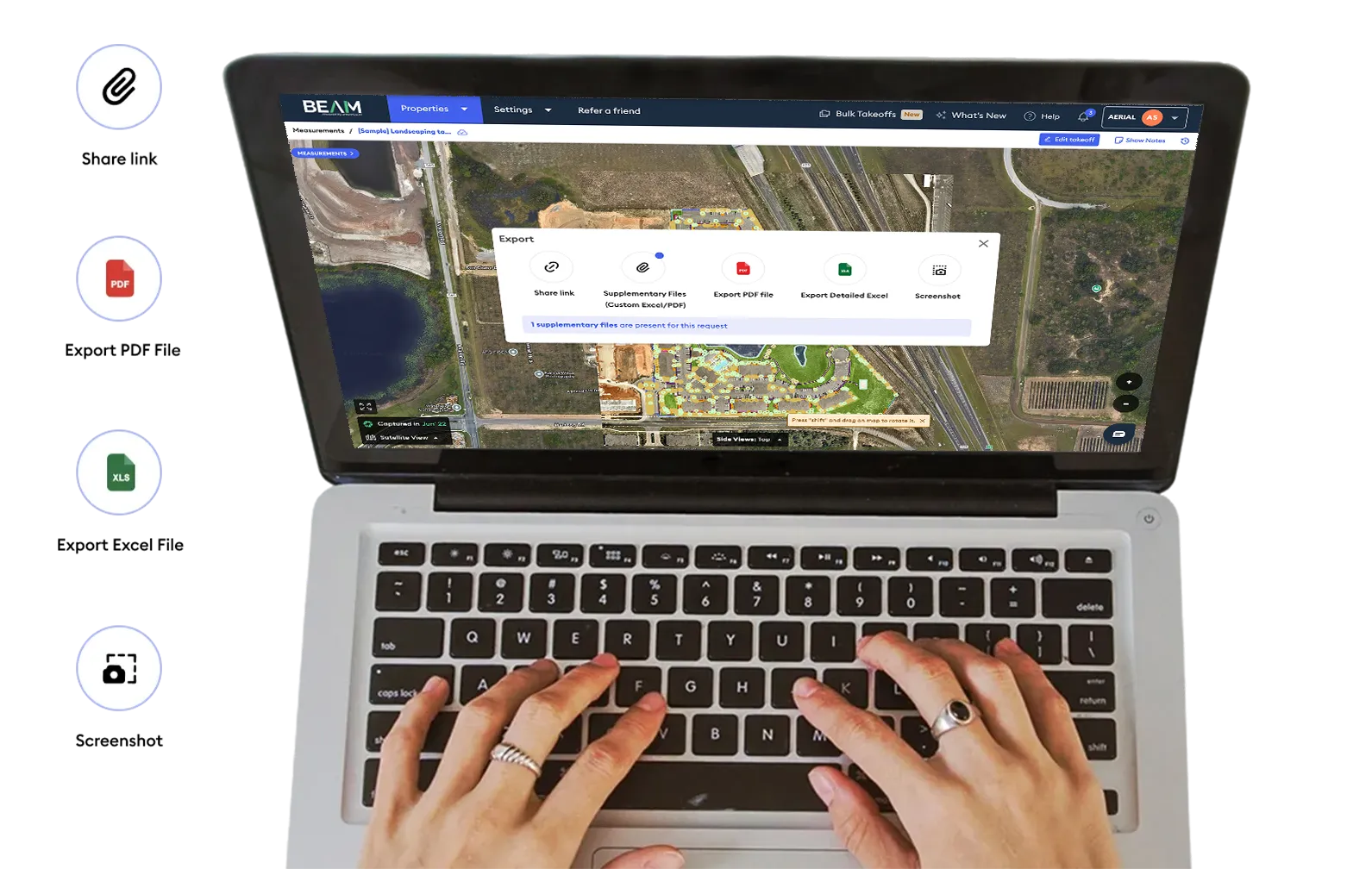
Get your shareable outputs in 6–48 hours
Receive your QA-verified takeoffs in color-coded, easily shareable outputs across Excel, PDF, and view-only links, ready for estimating or sharing with your crew.
What’s slowing snow contractors down?
Manual snow removal takeoffs are eating into your margins and holding back your growth.

Profitability lost to guesswork and costs
Snow contractors often rely on rough averages across multi-site portfolios, measuring only a fraction of properties and extrapolating the rest. This guesswork drives underbidding or overbidding. Add in the dedicated manpower and hours sunk into manual takeoffs, and estimating becomes an expensive, resource-heavy process.

Slow and resource-intensive bid cycles
Manual polygons, repeated site walks, and weather-exposed field visits delay bids while inflating costs on fuel, labor, and admin. These inefficiencies slow down sales cycles, limit scalability, and compromise safety, with inaccurate takeoffs leaving gaps in planning routes, equipment needs, and hazard identification.
AI-based takeoff software for snow removal contractors
Free up time, lower costs, and bid more competitively with AI-powered takeoffs.
Save 90% of your time on snow removal takeoffs
Beam AI captures measurements for drive lanes, sidewalks, parking lots, and pavements directly from aerial imagery. No field visits, no polygons, no guesswork, just accurate quantities.
2X your bidding capacity without extra overhead
With automation doing the heavy lifting, your team can process 100s of sites in bulk, cutting manpower costs and fuel spend. Free up resources to focus on strategy, upselling, and customer relationships.
See what our customers have to say
“With Beam AI, we went from measuring 60% of our jobs to 100% of our jobs. AI's ability to measure multiple jobs at once has drastically improved our estimating capabilities.”
Mark Michalek
Director of Business Services, Juniper
Read Success Story“With the US facing a labor shortage crisis, Attentive.ai’s AI-based takeoffs have proved to be money well spent. It’s helping the team spend more time on other critical tasks.”
Owner of a Virginia-based premier landscaping company
Read Success Story“Our partnership with Attentive.ai aligns perfectly with our long-standing commitment to provide our Franchise. with best-in-class resources, technology, tools, and training.”
Michael wood
Director of Project Management, US Lawns
Read Success Story“Beam AI has an impressively intuitive interface & ease of use. We have observed a remarkable increase in the efficiency of our sales team, with a notable boost in the time dedicated to sales activities.”
Bobby Ciampa
Vice President of Sales & Marketing, GreenView Partners
Read Success Story“Our experience with Beam AI has been outstanding. The intuitive interface and fast turnaround times have significantly streamlined our operations. Additionally, the support team is incredibly responsive & helpful.”
Matt Cline
CEO, Hillside Lawn
Read Success Story
The snow removal resource library: Built for contractors
Access blogs, datasheets, and playbooks to learn how top contractors are transforming snow removal workflows.
Snow Removal
Bidding
2 min read
How to Bid on Multi-Site Snow Removal RFPs

Beam AI
July 28, 2023
Master multi-site snow removal RFPs—learn how to overcome manual takeoff bottlenecks, avoid guesswork, and confidently manage portfolios of 2K–15K sites.
Read blog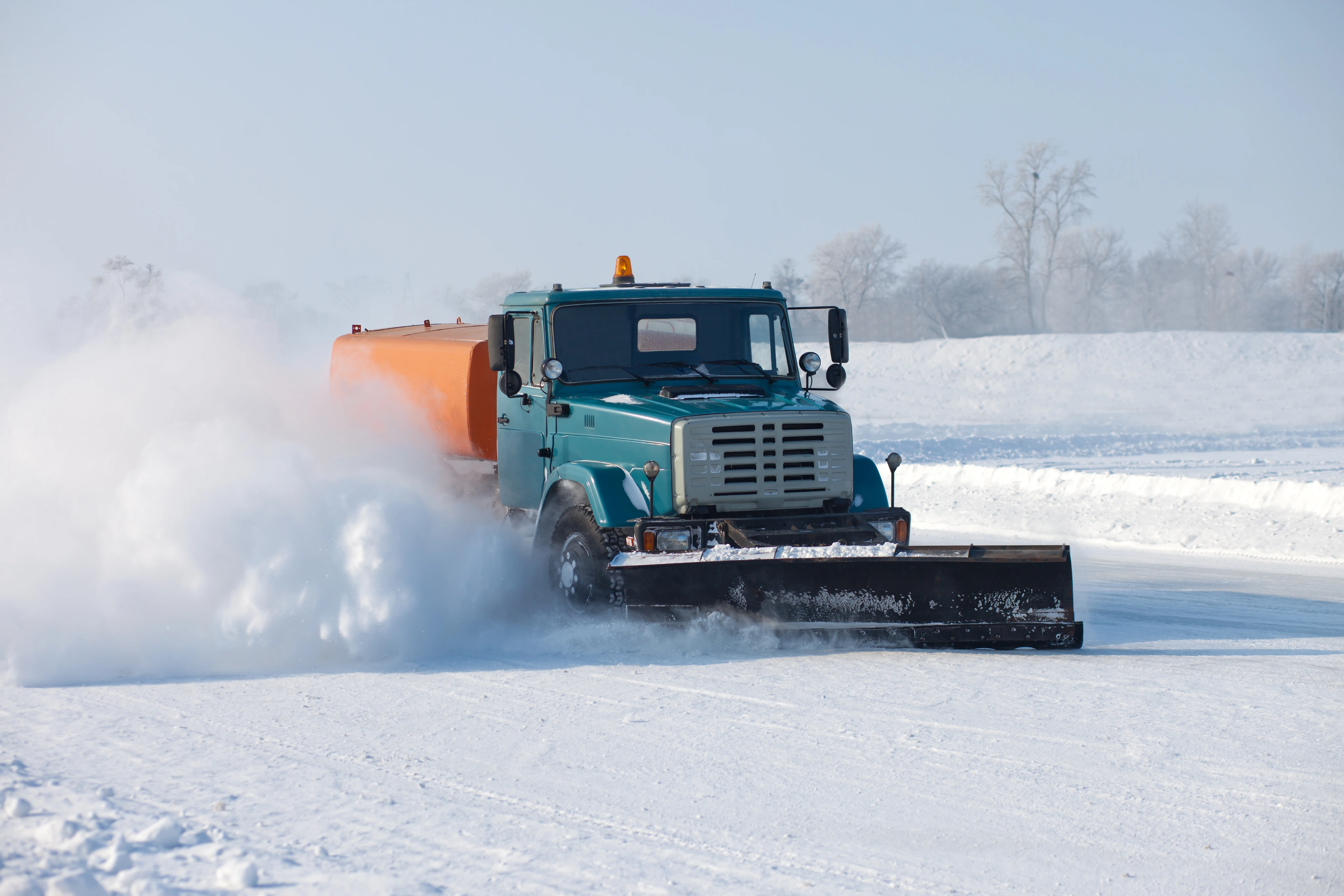
Snow Removal
Technology
2 min read
Top 20 Equipment & Tools for Landscaping & Snow

Arya Sharan
August 19, 2023
Discover the 20 essential tools and suppliers every landscaping and snow removal business needs, from efficient mowers to plows to advanced takeoff software.
Read blog
Snow Removal
Takeoff Software
2 min read
How to Use Takeoff Software for Snow Removal Jobs?
Beam AI
November 1, 2022
Streamline snow removal estimates with automated aerial takeoffs, learn how accurate site measurements can help you bid faster, stop guesswork, and win more jobs.
Read blogFAQs
What is a snow removal takeoff?
A snow removal takeoff is the process of measuring site elements, such as drive lanes, sidewalks, parking lots, and pavements, to estimate the manpower, equipment, and materials needed for snow & ice management jobs.
How does snow removal takeoff software work?
Beam AI automates the entire process with aerial imagery. You enter the property address, confirm the lot boundary, and let AI capture all quantities. Every output is QA-reviewed and delivered within 6–48 hours in shareable formats like Excel, PDF, or view-only links.
What is snow removal takeoff software?
Snow removal takeoff software is a specialized tool designed for the snow removal industry that uses high-resolution aerial imagery to automatically measure and analyze properties. It calculates precise areas for plowing, salting, and sidewalk clearing, allowing contractors to save time, improve bid accuracy, and create professional proposals for snow removal contracts.
How does snow removal takeoff software work?
Snow removal takeoff software works in three main steps:
- Property Input: Enter the address of the property to be serviced.
- Automated Analysis: The software uses aerial imagery to automatically measure areas, perimeters, and volumes relevant to snow removal tasks.
- AI does the quReport Generation: Detailed measurement reports are produced, which can be used to prepare bids, proposals, and integrate with other estimating platforms.
How does snow removal takeoff software help contractors?
Snow removal takeoff software, including platforms like Beam AI, helps contractors measure and estimate jobs accurately without needing a physical visit. It calculates snow removal areas, perimeter, and volume, allows for historical data tracking, and supports on-site notes. This enables contractors to submit precise bids, track profitability, and increase chances of winning contracts while saving significant time.
.webp)

